Via Romea Germanica XIII
Trento, Italy to Levico Terme.
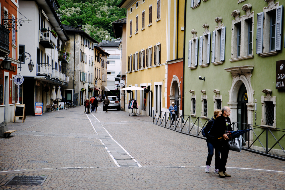
Today's Selfie
On a grey, cloudy morning, with rain threatening, we bid adieu to Trento. According to the guidebook, today was supposed to be the last of the significant hill climbs in the first half of the Via. After Levico Terme, the terrain would either trend downhill, or (through the Veneto) be flat.
As a special feature for any Camino de Santiago veterans reading this account, I would like to add a few observations about some of the differences we have noted between the Via and the Camino Frances, which Mary and I walked two years earlier.
Solitude may be the most striking difference between the two routes. On the Camino, from the moment we boarded the train to St Jean Pied de Port, we were surrounded by peregrinos. The Camino Frances, with its 100,000+ pilgrims each year, is awash in fellow travelers. It definitely had a community spirit, and it was often difficult to walk for any extended time by yourself. Wherever you were, there was always a backpack (or several) in front of you.
In monastic terms, the Camino Frances is the city, while the Via Romea is the desert. Thirteen days into our trek, and we have yet to meet another pellegrino. We have crossed paths with day hikers and bicyclists, but no one walking to Rome. Were we not together, we could walk long days without speaking at all. If you are a highly social person, and need the distraction of talking to help take your mind off the miles while you walk, the Camino Frances is probably a better choice.
More reflections to come…
Welcome to the Peripatetic Historian's multi-part series about hiking the Via Romea Germanica.
If you have stumbled across this installment by accident or a fortuitous Google search, and have no idea what is happening, you might prefer to begin at the start of the series, here: Introduction to the Via Romea Germanica
Otherwise, let's return to our story, already in progress.
As noted just moments ago, the most challenging aspect of today’s route was the climbing. We left Trento in the rain, and slowly ascended a long hill toward the Passo del Cimirlo, a low point in the saddle formed between two mountains, Mt. Celva and Mt. Marzola. The stage climbs 540 meters over seven kilometers. The first, and steepest part of the course was over a pathway paved with rounded, smooth stones. This surface, slippery when wet, is a specialty of this region. It was like climbing the stairway to heaven without any stairs.
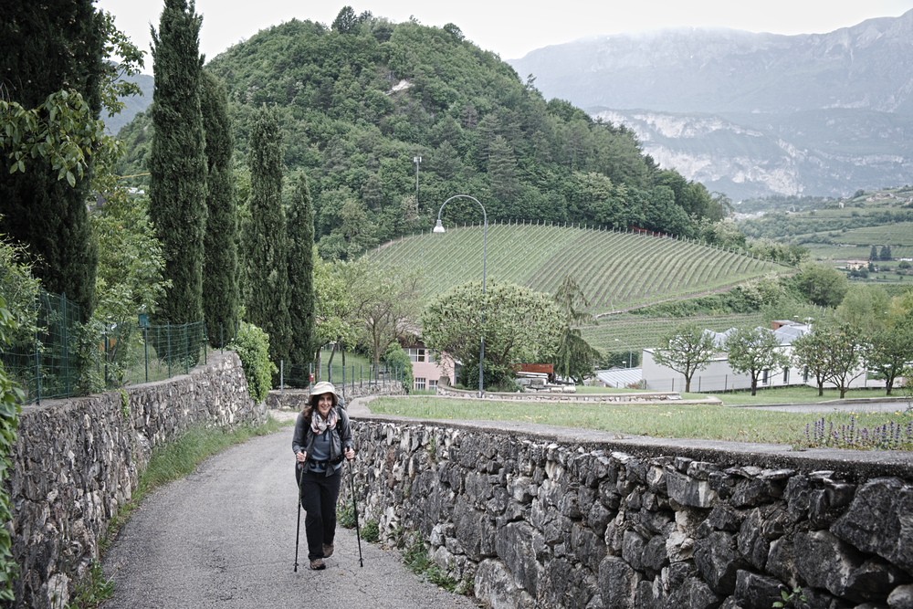
Mary climbing out of Trento
The roads and trails ran higher. The rain steadied and the wind began to sigh in the pine forests. Eventually we reached the Passo del Cimirlo, which meant it was time to begin a steep descent.
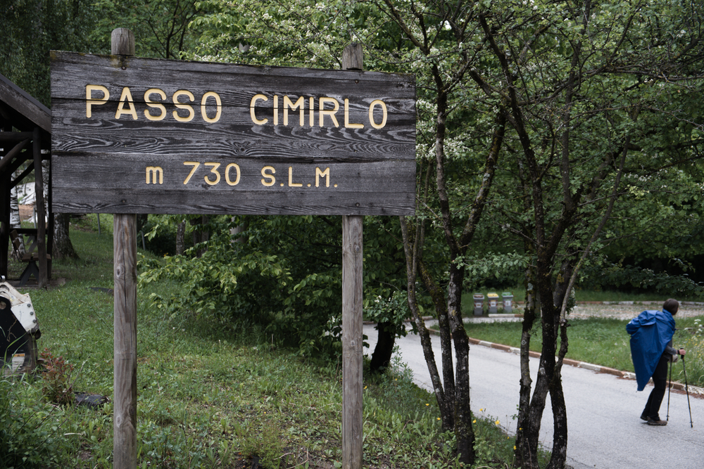
The Passo del Cimirlo
Your tastes may differ, but I find that there is virtually nothing harder on my feet and joints than a long downhill segment. By the time we limped down from the Passo del Cimirlo, my feet and ankles were screaming. Give me a nice uphill course (as long as it is not too steep), or, ideally, a flat dirt trail.
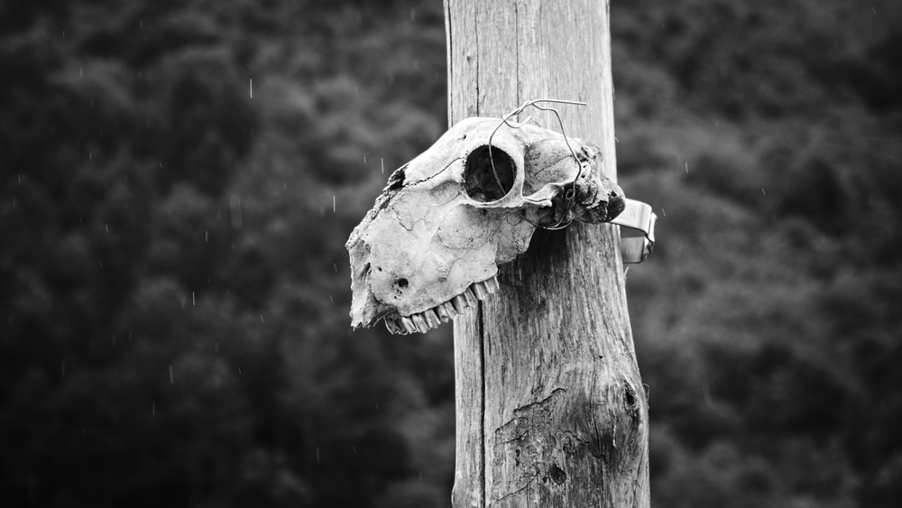
Some walkers don't make it over the Passo del Cimirlo
We strode into Pergine, a town that stands a little past the halfway mark of the day’s stage. Once we passed through the modern part of the town and made it into the historical center, I found Pergine perfectly charming. It had beautiful old Renaissance buildings, a lovely piazza, and narrow streets simply dripping with character. If I was walking the Via again, I would book a room in Pergine for the night, simply to secure more time for looking around.
We compromised by taking a rest stop. Mary had water and a muffin, while I tried to order an espresso. My Italian pronunciation must be improving: the waitress brought me an espresso this time, rather than a flute of beer.
In the streets of the delightful Pergine, Italy
After Pergine, the trail angled up again, to pass below the Pergine Castle. We had a much better view of the castle from the town below. Once we had climbed another slick stone path, the trees blocked our view, and it wasn’t until we has passed it that we could once again see it crouched on the hill behind us.
It would appear that this medieval castle is now a restaurant and hotel, which might explain why the guidebook did not encourage us to extend our walk by climbing up to its thick stone walls.
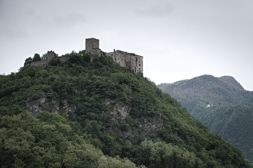
Pergine Castle
Eventually our route led us above Lake Caldonazzo and through the vacation town of Ischia. This town is still waiting for the return of summer. Most of the houses had shuttered windows, and the driveways were empty. No one was out on the lake, and a desolate wind blew through the alleys and streets of the town. Another month and the town will undoubtedly be heaving, but not today.
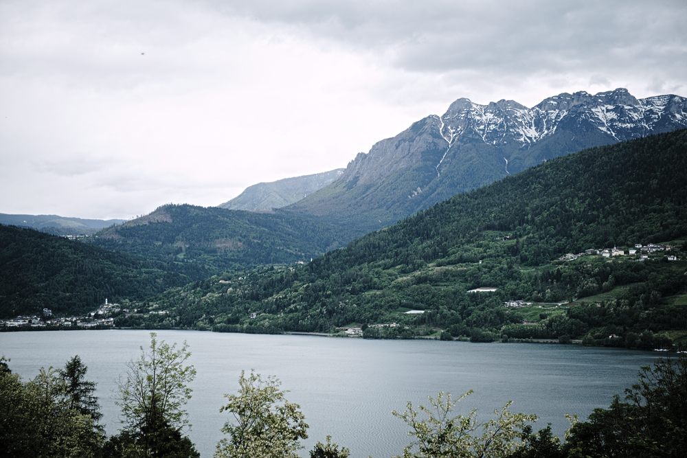
Lake Caldonazzo
After Ischia, the stage runs through a nature reserve on a steep, downhill trail. The trail is narrow, no wider than eighteen inches in places, and bordered by a steep drop off on the left side. Most ominously, one of the signboards said we were heading for the Val de l’orco—Valley of the Ogre, if my Italian hadn’t deserted me. I imagined the ogre waited in the bushes and then pushed people off the narrow trail when they went by. Quite fiendish.
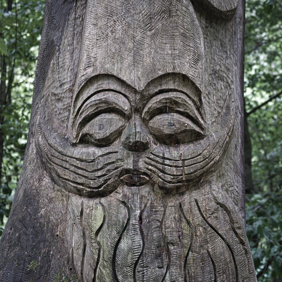
Totem found in the Val de l'orco
At the bottom of the hill, the trail widened, and then flowed into a mud swamp. Water, running downhill, was using the trail as a path of least resistance. The ground was heavily saturated. We slogged through the mud, trying to keep our shoes from sinking ankle deep. Eventually the water found its way to a nearby stream and the path dried out again. The stream grew from a trickle to a creek, gaining width and volume as we continued downhill.
At the bottom of the hill was a small wooden bridge that crossed this stream. We examined the signs very carefully, and all were rather confusing (one sign, for example, indicated that our destination, Levico Terme, was in the direction that we had just come). There was one sign that was crystal clear, the small Via Romea arrow that directed us to continue straight ahead. We did so, passing by the bridge and continuing straight along the path we had been following. Eventually the lake emerged on our left side, and we walked on a rolling, but wide and soft trail.
After fifteen minutes, I felt prompted to check my GPS. To my shock, horror, and dismay, I realized that, contrary to the clearly posted arrow, we should have turned left at the bridge to proceed on the opposite side of the lake. We were on the wrong side of the lake. This was not a fatal blunder as our trail did eventually connect with Levico Terme, but it did add at least an extra kilometer to the day’s hike.
In any event, we eventually made it to town. It is all downhill to the Veneto from here.
Today's distance: 23.4 KM Total distance: 219.26 KM
If you are enjoying this series, why not subscribe to Richard's monthly newsletter, What's New in Old News? The Peripatetic Historian is on the road, roaming the world and compiling fresh adventures. Don't miss out. Click here to join the legions of above-average readers who have already subscribed.